


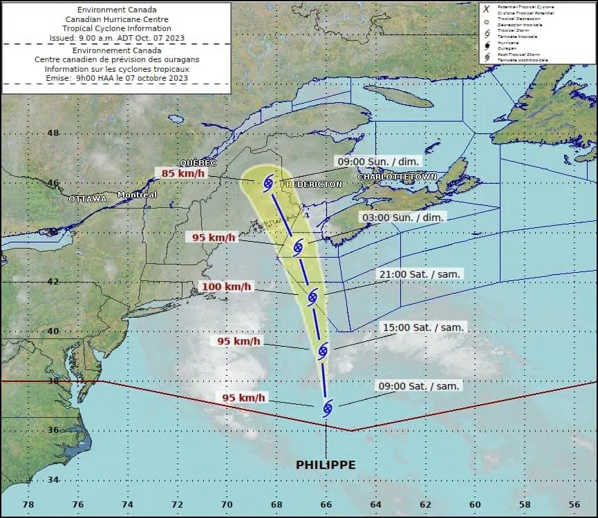
Some wind and rain warnings are in place ahead of the lastest system making its way past the Maritimes.
The warnings for Philippe include areas along the Atlantic coast of Nova Scotia, including parts of Halifax.
Wings gusts up to 90 km/h are expected Saturday night into Sunday.
Nova Scotia Power says has crews ready to respond to any outages.
Meantime, the highest rainfall totals will come in around up 60mm in southwestern Nova Scotia while other areas will see up to 30mm.
“Rainfall amounts are forecast to be in the 40 to 60 millimetres range in Digby, Yarmouth, Shelburne, Queens and Lunenburg counties where there is a rainfall warning in effect. Rainfall amounts of 30 to 40 millimetres are forecast for Annapolis and Kings counties and Halifax.” – Environment Canada
The storm is not expected to be as intense as Lee when it arrived two weeks ago but it could still disrupt one weekend plans if the power goes out.
“As with the winds, we don’t expect waves and storm surge to be as bad as Lee, but the same stretch of coast impacted by Lee will be affected by ex-Philippe. There could be some wave overwash and minor coastal flooding around high tide approximately 4:30 am. It looks like the peak conditions will occur closer to low tide now, which is mid-morning on Sunday.” said Environment Canada